
Genoa Township ZIP Code Coverage
Three documented mailing patterns serve Genoa Township: Brighton 48114, Brighton 48116, and Howell 48843. These are delivery patterns, not a set of municipal borders. The authoritative Livingston County ZIP Codes map gives countywide orientation, and the USPS address lookup decides the delivery ZIP for an exact number and street. A Genoa Township parcel may carry a Brighton or Howell postal label while remaining in the township.
| ZIP | Areas Covered | Post Office | Notes |
|---|---|---|---|
| 48114 | Portions of Genoa Township using the Brighton and Gregory-area delivery pattern, including the broader rural southern and western pattern on county mapping | Brighton-area USPS delivery | Fillmore County Park in Genoa uses a Brighton 48114 label. Verify the exact street and number. |
| 48116 | Genoa Township addresses using a Brighton mailing city | Brighton Post Office, 100 Orndorf Drive, Brighton, MI 48116 | The Genoa Township office uses this postal pattern. The mailing city is not municipal jurisdiction. |
| 48843 | Genoa Township addresses using a Howell mailing city in the northern and eastern county pattern | Howell Post Office, 325 S. Michigan Avenue, Howell, MI 48843 | A Howell label does not place land inside the City of Howell. Check parcel and township fields. |
No official source located a separate Genoa post office, a unique Genoa ZIP, or a PO-box-only Genoa ZIP. No Genoa-specific ZIP split or realignment year was verified either. Those missing findings matter: a precise-looking postal history should not be invented from a map label.
Genoa Township ZIP Delivery Checks
Run a ZIP check from the full delivery address, not the township name alone. The USPS ZIP Lookup offers address, city-and-state, and ZIP-to-city search modes. USPS notes that a ZIP result does not confirm that a particular person or company is at an address. It confirms postal delivery information.
48114 workflow
For a Genoa Township address that appears to use 48114, enter the street number and road in USPS first. Then compare its county parcel record and GIS popup. This is especially useful for the rural and southern or western pattern because a Brighton-area delivery label does not decide whether the land is in the City of Brighton.
48116 workflow
For 48116, verify the full address with USPS and then use the City/Township/Village field in Livingston Property Search to check Genoa Township parcel context. The township office itself shows how a Brighton 48116 postal address can belong to the township rather than the city.
48843 workflow
For 48843, begin with the exact delivery address and then check the assessor and GIS records for township, parcel, and legal-description information. A Howell mailing city is a postal routing clue. It is not a tax, zoning, election, or court-jurisdiction answer.
Note: USPS verifies delivery, while county parcel and GIS records verify the government geography attached to the land.
Genoa Township ZIP Lookup Fields
USPS is the ZIP-capable lookup documented for this Genoa Township task. It is best used to verify the delivery ZIP or recognized city for one address. The county property, GIS, deed, and voter tools do not expose a verified ZIP-browse field. Their search controls remain useful after the delivery result is known, but they should not be described as ZIP-wide lists.
| USPS search mode | Fields or input | What it verifies |
|---|---|---|
| ZIP Code by Address | Company, street address, apartment or suite or other detail, city, state, ZIP, and Find | Delivery ZIP for the submitted address and recognized delivery information |
| ZIP Code by City and State | City, state, and Find | Postal ZIP possibilities for a city and state search, not a parcel boundary |
| Cities by ZIP Code | ZIP and Find | Postal city names associated with the supplied ZIP |
| Property Search | Owner, parcel, address, property type, active status, City/Township/Village | Parcel and tax context; no exposed ZIP field |
| GIS viewer | Address components, parcel ID, owner, subdivision or condo, all categories | Parcel geography and property-summary link; no exposed ZIP field |
Livingston Property Search has a municipality dropdown, but no exposed ZIP field. Its results can be grouped cautiously by the mailing or situs fields after a search, not generated as a verified ZIP-wide query. GIS similarly searches address components, parcel IDs, owner names, subdivision labels, and broad categories. It maps the area but does not offer a documented ZIP filter.
Genoa Township ZIP Search Steps
A ZIP narrows a delivery area, but it does not create a directory of everyone connected to that area. A careful Genoa Township postal workflow moves from delivery verification to a known parcel, then to an official record type that is actually indexed. Once a street is identified, the detailed address chain belongs with the Genoa Township by-street directory.
- Use the USPS address mode with the full street address and save the delivery ZIP and recognized postal city.
- Search the same number, street, and Genoa Township in Livingston Property Search, then preserve the situs, mailing field, owner field, parcel ID, and legal description that appear.
- Open the parcel in the county GIS viewer and compare its popup, road context, acreage, districts, and property-summary link.
- If recorded ownership history matters, search the Register of Deeds by a confirmed party and legal description. The deed index has Government Unit and parcel or legal-description filters, not a verified ZIP filter.
- Keep postal, parcel, and legal-description results separate. A mismatch is a reason to verify the record, not a reason to merge the fields.
The Michigan Voter Information Center is a person and registration lookup, not a ZIP browsing tool. A Qualified Voter File request can define jurisdiction and fields under its rules, but ZIP grouping would be downstream work and remains subject to redactions and protected-address safeguards.
Genoa Township Postal Parcel Keys
Genoa Township records are easier to reconcile when each key keeps its own job. The ZIP describes delivery geography. A situs address locates the land. A mailing address shows where tax correspondence goes. The legal description identifies land in recorded-document language, and the parcel ID ties the county property record to the GIS map. These fields often agree, but they are not interchangeable.
- ZIP code
- A postal delivery area. It helps route mail and is not a legal municipal boundary.
- ZIP+4
- An added four-digit delivery detail used by USPS after the five-digit ZIP. It does not change a parcel’s jurisdiction.
- PO-box ZIP
- A postal ZIP assigned for post-office-box service. No Genoa-specific PO-box-only ZIP was verified in the available official material.
- Unique ZIP
- A ZIP assigned to one institution or large recipient. No unique Genoa ZIP was located in the sources reviewed.
- Carrier route
- A USPS delivery-route designation. It is a postal routing detail, not a township boundary or land-record key.
Livingston GIS uses a parcel ID without the leading county code 47, while the property portal displays a county-coded parcel structure. That format difference is separate from the ZIP issue, but it can create a false no-result when a Genoa Township address is moved between the two tools.
Genoa Township ZIP Boundary Myth
MYTH. A Brighton or Howell postal city proves the parcel is inside that city. Genoa Township provides clear counterexamples. Its office uses a Brighton 48116 address, while Fillmore County Park is in Genoa Township with a Brighton 48114 address. Howell 48843 can also label township property. The envelope label reaches a post office; it does not set local government jurisdiction.
Use county parcel and township fields for tax, zoning, election, and court questions. Use the county ZIP map for a broad visual orientation. Use USPS for one exact delivery address. Keeping those jobs distinct prevents a familiar postal city from displacing the actual Genoa Township record context.
Genoa Township ZIP Data Gaps
There is no verified official table for Genoa Township population or registration by postal ZIP. The absence should shape the search. Township figures cannot be divided into 48114, 48116, and 48843 without a documented data method, and a ZIP result cannot be turned into a township resident count. Census products are helpful for township-level context but do not replace a ZIP-specific official roll.
Census QuickFacts for Genoa Township reports a 2020 population of 20,692, a 2025 estimate of 20,576, and 33.84 square miles of land area. Those figures are township-wide and should remain labeled with their source years.
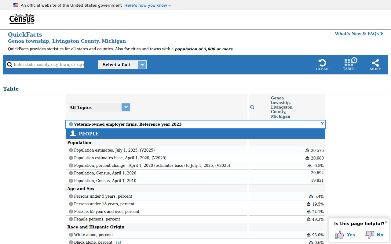
The QuickFacts display supports context for Genoa Township as a whole, while the three mailing patterns still require address-by-address verification.
Genoa Township ZIP Verification Tip
INSIDER TIP. Begin with the delivery address, then move to the parcel. USPS makes the exact mailing result the first check. The county property and GIS systems make township and parcel context the second check. Reversing the order can produce a convincing but incomplete answer when a Genoa Township address uses a Brighton or Howell label.
USPS ZIP Lookup is the official source for checking a recognized delivery address and ZIP.
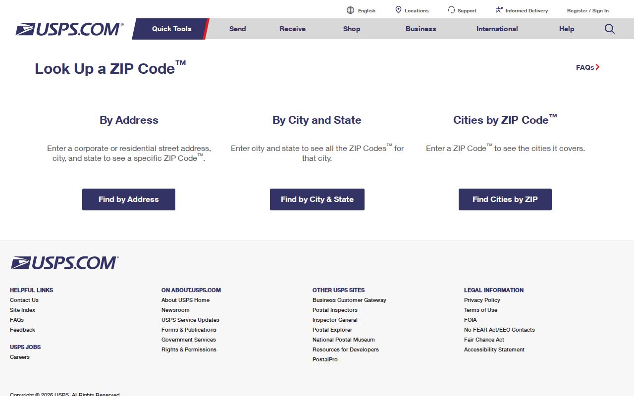
The lookup result should be saved with the full street address, then compared against the township, parcel, and legal-description fields in county records.
Note: An exact USPS result confirms a delivery route, not the current person at an address or the municipal jurisdiction of the parcel.
Genoa Township ZIP Boundaries
ZIP boundaries and Genoa Township limits overlap without matching. Genoa is a charter township in Livingston County, not the City of Brighton or the City of Howell. Postal labels reflect the postal-service network, while the county property system and GIS identify the township, parcel, road, and district. A ZIP-wide result is therefore not the same thing as a Township-wide record set.
When an address appears outside expectations, check the number and road with USPS, compare the site address and parcel in county tools, and contact the relevant custodian for a record-specific question. Do not infer private household membership from delivery data, parcel maps, or public district layers. The county layers can show roads, precincts, commissioner districts, school districts, and other public geography, but they do not disclose a household roster.
Lawful use. Genoa Township postal and parcel information is for lawful personal research and civic or property context. Do not use it to harass someone, pursue a protected address, or treat a delivery result as private household data.